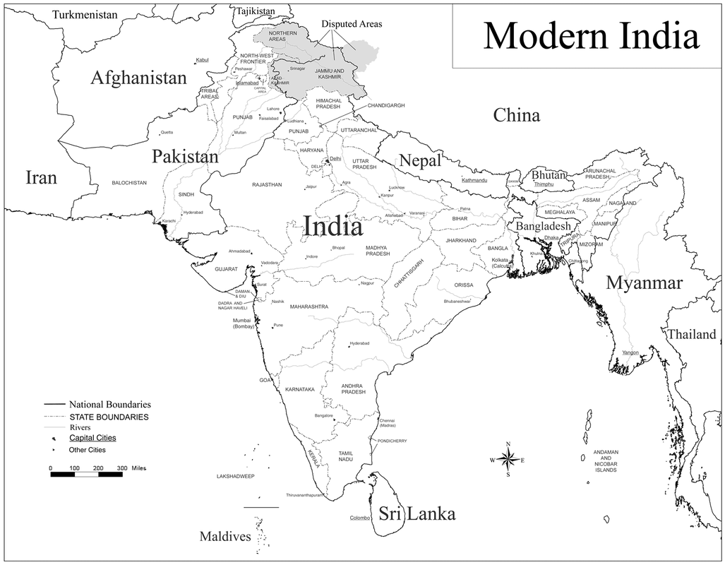
Boundaries of India
In the north, the neighbors of India are China, Nepal and Bhutan. To the northwest the neighbor is Pakistan. To the East is Myanmar. Bangladesh forms almost an enclave within India. The tropic of cancer almost divides the country into two halves. To the south of the tropic of cancer the Indian land mass lies between the Bay of Bengal in the east, Arabian Sea in the west and Indian ocean in the south which are all physical, water boundaries.
The boundary line between India and China as well as India and Bhutan is called the MacMohan line. It runs from the eastern border of Bhutan along the crest of the Himalayas until it reaches the great bend in the Brahmaputra River where that river emerges from its Tibetan course into the Assam Valley. It is a physical boundary because it follows the Himalayan Mountains.
The boundary between India and Nepal is based upon a cultural difference of language.
The line separating India and Pakistan in known as the Radciffe Line and is a cultural boundary It was drawn based upon the religions in India which were Hindu and Muslims. There is much ethnic conflict in the Kashmir Region which is a border.
The boundary between Myanmer and Bangladesh was created to separate countries that would otherwise share a boundary.
In the south on the east side, Gulf of Mannar and Palk Strait separate India from Sri Lanka. This is a physical water boundary.
The boundaries between the 29 states in India are primarily cultural, meaning they are based upon language and religions.
